The Pacific Marine Circle Route is the perfect weekend drive.


Starting off in Victoria, head north along the Trans Canada Highway (Hwy 1) through Goldstream Park, over the Malahat and into Duncan. Continue along for about 15-20 minutes until you hit the Lake Cowichan (Hwy 18) turnoff. Lake Cowichan is located at the eastern end of Cowichan Lake (Vancouver Island’s second largest lake.) It’s a small resource town with an economy based on tourism and logging. It's a popular spot for fishing, camping and riding ATVs. We stopped for lunch at Dermod and Dudley’s Irish Pub. It’s on the main street and has great food, good service and front row views of the lake. After our lunch we checked out the museum and took pictures on the old steam engine and caboose (yes - this is entertaining for adults as well.) Before leaving the town - make sure your gas tank is full.


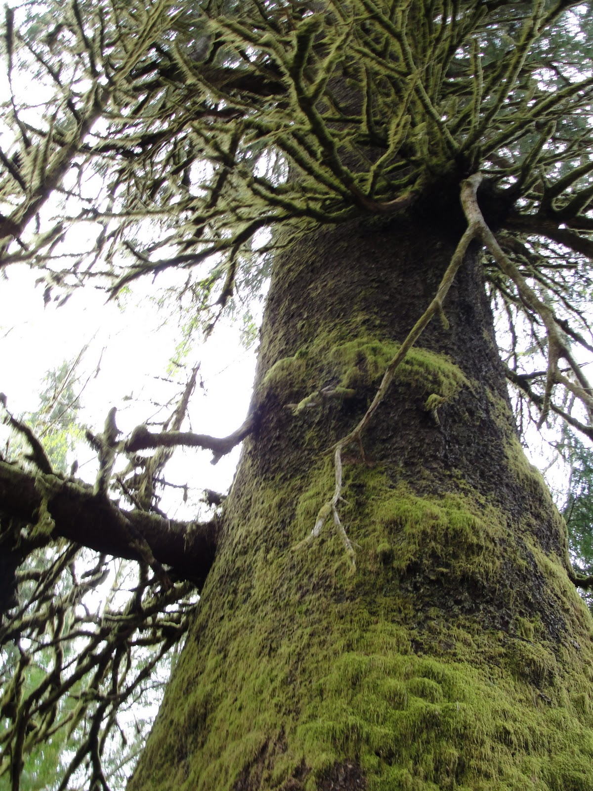
Closer towards Port Renfrew - you absolutely must stop for a giant. It’s a massive Sitka Spruce that’s managed to survive decades of logging. This single tree was spared for our enjoyment - and just standing next to it - leaves you in awe. Watch for the signs on the left side of the road - you can't miss it.

 |
| Pink Fawn Lily |
Along the route, there are several active logging roads that branch off. Some are in better condition than others. Unless you have a backcountry road map - I wouldn't recommend venturing too far down them. We explored one of the most popular side roads leading to the Juan De Fuca Wilderness Camp (about a 15 minute drive ). Interesting yes - necessary no.


AHHHH - Port Renfrew. The town is home to about 200 residents. It's probably best known as the 'starting point' for the West Coast Trail and the 'finishing point' for the Juan de Fuca Marine Trail. There are a few restaurants, a small grocery store, several rugged fishing resorts and a few Bed & Breakfasts.

About five minutes from Port Renfrew is Botanical Beach (Juan de Fuca) Provincial Park. Provided you have $3 dollars in change - it's a great place to stretch your legs and head down to the shoreline. One hour and 2 or 3km's later - you'll have experienced some great views, a walk along the beach and you'll get a real feel for the ruggedness of the west coast.


After leaving Port Refrew (with a fresh coffee in hand,) the road to Jordan River and Sooke winds along the coast. Watch for signs that direct you to provincial campgrounds and entry points for the Juan de Fuca Marine Trail.
The Pacific Marine Circle Route is roughly 250km long depending on how much you veer off. It offers something that's off-the-beaten path and provides travelers with a sense of what the South Island is all about. It's particularly great for putting the geography of the area in perspective. Bring a map with you - not only for obvious reasons - but it's fun to follow along - and make notes of places you'll visit next time! The route provides spectacular views of Juan de Fuca, Haro and Georgia Straits. We would recommend doing this trip when the forecast is good and you've got time to stop and smell the sea air.
All in all - our adventure took 8 hours. Enjoy the journey!