KEREMEOS, BC - When you read the word “column” – what image pops into your head? A supporting beam on a prestigious building? Something from Rome or Athens? How about naturally-formed rock structures in the hills above Keremeos?
I first visited the columns this week, but apparently they’ve been a popular hiking destination, especially with locals, for years. In 1931, the provincial government created Keremeos Columns Provincial Park. But funny enough, the columns themselves are not actually located within the 50-acre park boundary. A 1954 survey showed they were on private property adjacent to the park. Therefore, there are no marked trails showing you how to reach the columns, but you can find them by following a route that takes you up the mountain along an old dirt road.
Lucky for us, our hiking partners were experienced local outdoor enthusiasts, had been there before and knew where to park. If you’re driving south from Penticton along Highway 3A, just past Olalla, turn left on Liddicoat Rd. We parked our vehicles at the corner of Liddicoat Rd. and Pin Cushion Trail, in an area where there are several lots for sale. Parts of the route cross over private property, and you’re asked to call the owners beforehand to let them know you’ll be hiking in the area. (Wilson Clifton 250-499-5638 or Brad Clifton 250-499-5180)
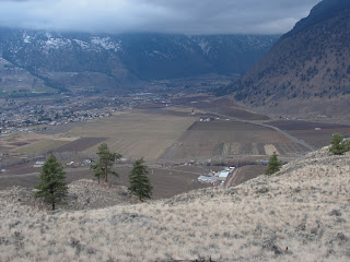
From the parking area, you begin climbing the old dirt road that zigzags its way up the hill overlooking Keremeos. After about 45 minutes, you’ll pass several cell phone/radio towers on your left. Stay on the main road and continue up the hill. Behind you, on a clear day, you’ll have the view of the town as a reference point. For the most part, the area is quite exposed, and the landscape is covered in silvery-green sagebrush and golden grasses. Watch out for grazing cattle. About 90 minutes later, you’ll pass old equipment on your right, once used to gather water from a natural spring. Beyond a cluster of trees, you’ll find what you’ve been searching for!
When I first saw the columns, I couldn’t believe they were naturally formed. They look like huge tube-shaped structures of rock – rising about 30 metres high. They form a cliff about 100 metres wide. Between the cracks and crevasses, massive trees have managed to flourish, providing a cathedral-like space. The columns were created millions of years ago by slowly cooling lava. As the basalt rock cooled, it formed vertically-hexagonal shapes. Many of them have already crumbled, piling up at the base of the cliff. According to BC Parks, these columns share the same geological phenomenon status as the Giant Causeway in Northern Ireland and the Devil's Tower in Wyoming.
After exploring the columns, we traversed the hill to a lookout on the other side. Chunks of broken columns (deposited by glaciers) are scattered randomly along the way. Despite the low hanging cloud cover, we enjoyed a spectacular view. To the southeast is the town of Cawston. Further down the Similkameen Valley and just across the U.S. border is the town of Nighthawk. Keremeos is to the west.
The name Keremeos originated from the Similkameen dialect of the Okanagan language word "Keremeyeus" meaning "creek which cuts its way through the flats." This refers to Keremeos Creek, which flows down from the Upper Benchlands to the Similkameen River. Local legend claims the name also means "the meeting of the winds," because of the windy conditions often experienced in the valley.
We returned to our vehicle about five hours after we left, following the same route back down. If you’re hungry afterward, check out the Benja Thai Restaurant on Main Street in Keremeos. Great food!
-erin


