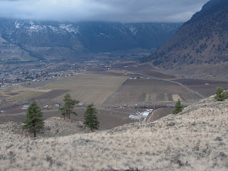
OLIVER, BC – It rises 300 vertical metres from the ground overlooking Highway 97 between the towns of Oliver and Okanagan Falls. Like a natural gateway through the South Okanagan, McIntyre Bluff is a magnificent land formation created millions of years ago through a combination of mountain building processes and several periods of glacier erosion.
After driving past it many times, naturally I had a desire to get to the top as I do with most unusual mountains or landforms I see. Our friend Dino knows the region well, so when he recommended we take a three-hour hike to the top and back, I was in. The bluff is located in the White Lake Grasslands Protected Area. According to BC Parks, the dry grasslands and open pine forests of the South Okanagan are one of the four most endangered ecosystems in Canada.


To understand how special the area is, both ecologically and historically, you have to experience it for yourself. The natural colours of the landscape - sages, browns, yellows and greens – set against the bright blue sky make for a photographer’s dream. And there’s a strong sense this land has been inhabited for hundreds of years. Many locals refer to the bluff as Indian Head, because they say that from the south, the rock resembles the profile of a man’s face. According to local First Nations, at one time the top of the bluff was the site of a battle between their people and invaders from the south. Legends tell of fighters forced off the bluff – falling to their death below. Fur traders also pushed through the area, travelling from the Fort Okanogan in Washington State along the famous Fur Brigade Trail on their way to Kamloops and beyond.
There are several ways to access trails in the area. We parked on adjacent property belonging to Covert Organic Farms (off Highway 97 at Seacrest Hill Rd.) You are welcome to start here as long as you let the owners know.
Mountain bikers use this area heavily in the summer, and there are markings along the route we took. Because you are fairly high up, it’s easy to find your bearings and make your way to the edge of the bluff. However, some of the trails can be confusing. We suggest bringing along a friend who knows the area, or carry a compass and map.
As we walked along the top of the plateau, I couldn’t help but imagine a fierce war where people were chased to the bluff’s edge. Did they know how close they were to the drop off? Was the attack planned? Today, the area is peaceful, providing a great place to soak up the winter sun and enjoy a fantastic view.
Once you’ve reached the bluff, you can look north to Okanagan Falls and Vaseux Lake and south to Oliver and Osoyoos. Keeping in mind this is a working valley, you’ll also get a bird’s-eye view of a small power station, cars and trucks zipping along, vineyards, orchards and a nearby mobile home park. (Exciting? I know!)
One more note: the Osoyoos Indian Band refers to the bluff as “Nie-ling-tin” or “storyteller.” Several pictographs mark the bottom corner face of the bluff, but we didn’t have time to see them. I’ll leave those for our next visit.
-erin
More resources:
Covert Organic Farms
www.covertfarms.ca
http://www.env.gov.bc.ca/bcparks/explore/parkpgs/wht_lk_grass/
http://www.trailpeak.com/trail-McIntyre-Bluff-near-Oliver-BC-5868
www.rdosmaps.bc.ca/min_bylaws/.../McIntyreBluff_combined.pdf


